Associated Incidents
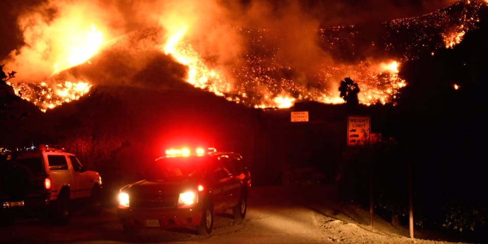
Emergency crews in Southern California block a roadway as flames spread from a wind-driven brush fire. REUTERS/Gene Blevins
Southern California residents and visitors fleeing the wildfires raging around Los Angeles are contending with a new problem — mapping apps that are reportedly directing them towards areas that are on fire.
The Los Angeles Police Department (LAPD) is warning area residents and visitors that apps that offer driving directions are sometimes suggesting routes through regions that are ablaze, The Los Angeles Times reported.
Apps such as Waze and Google Maps take traffic into account when calculating routes and will often suggest that drivers take roads that appear less busy. However, they apparently aren't calculating in the fact that those routes may be free because of the fire danger.
The LAPD is reportedly warning those in the area not to use any navigation apps.
The out-of-control fires are blazing in parts of Los Angeles and Ventura counties, and nearly 200,000 people have been affected by mandatory evacuation orders. Winds of up to 80 miles per hour are exacerbating the conditions, and a state of emergency has been declared.
The fires have periodically closed major routes in the area, including Interstate 405 and Highway 101, making it more difficult for people to get around. The California Department of Transportation is providing an updated map that shows the locations of the areas affected by the fire.